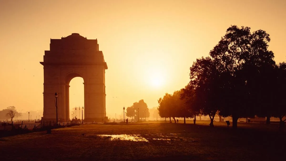
The early onset of winter in Delhi 2026 arrived with sudden unseasonal rain. It also brought daytime temperatures down to the lowest October level seen in four years.
India Meteorological Department (IMD) has noted that the Safdarjung base observatory logged a daytime high of 25.4 degrees Celsius which is a sharp 5.6 degrees below seasonal norms.
This time the rain fall was accompanied by brisk northeasterly winds.
On a positive note the weather shift also flushed out thick morning haze. Delhi NCR residents rare breathable air is back with the lowest recorded AQI on October 29th 2026.
Read more about the early arrival of winters in Delhi NCR and what IMD forecast hints about the upcoming winters hereon.
Why Delhi NCR Experienced Coldest October Day in 4 Years?
The sudden dip in mercury across Delhi, Noida, Gurugram, and Ghaziabad on October 29th was driven by two overlapping meteorological systems.
A fresh western disturbance over northwest Uttar Pradesh merged with moisture drawn from the outer bands of Cyclone Arnab.
This dual system triggered widespread light rain, thunder, and persistent cloud cover that blocked solar heating across the northern plains.
Related Stories
|
Meteorological Parameter
|
Recorded Figure (October 2026)
|
Historical Comparison
|
|
Safdarjung Maximum Temp
|
25.4°C
|
5.6°C below normal
(Lowest since 2022)
|
|
Lowest Night Minimum
|
16.2°C
|
0.4°C below seasonal average
|
|
Average AQI Post-Rain
|
174
(Moderate category)
|
Down from 360+
(Very Poor)
|
|
Peak Wind Velocity
|
30 to 50 km/h
|
Dispersed surface particulates
|
Before this drop, the last time Delhi recorded a cooler October day was on October 8, 2022, when the daytime high touched 23.4 degrees Celsius.
How Rainfall Improved Delhi NCR AQI in October Today?
The rain functioned as a natural air scrubber by pulling the city out of the hazardous Very Poor zone today (October 30th).
The Central Pollution Control Board (CPCB) reported that ambient AQI numbers hovered in the moderate 150 - 190 band across most stations right after the showers.
-
Rain knocked down suspended coarse dust (PM10) and fine toxic soot (PM2.5) across urban corridors.
High-speed surface gusts prevented the formation of early winter inversion layers where cold air traps tailpipe smoke near the ground.
Wet ground across neighboring agricultural belts in Punjab and Haryana temporarily slowed down crop residue burning.
Meteorologists caution that this AQI relief remains transient. Skies do clear up over the weekend but drop in night temperatures combined with calmer winds will likely trap everyday urban emissions once again.
What is 7 Day IMD Weather and AQI Trend for Delhi NCR?
|
Date
|
Day
|
Max Temp (°C)
|
Min Temp (°C)
|
Sky & Weather Conditions
|
Projected AQI Band
|
Primary Dominant Factor
|
|
Oct 30, 2026
|
Friday
|
26 – 28
|
16 – 18
|
Generally cloudy; light drizzle/mist early morning
|
100 – 140 (Moderate / Borderline Poor)
|
Surface wetness, high humidity (90%+)
|
|
Oct 31, 2026
|
Saturday
|
28 – 30
|
15 – 17
|
Partly cloudy sky; calm easterly winds
|
150 – 210 (Moderate to Poor)
|
Drop in wind speed, residual moisture trap
|
|
Nov 01, 2026
|
Sunday
|
29 – 31
|
16 – 18
|
Clear sky; shallow morning haze
|
200 – 260 (Poor)
|
Wind reversal to northwesterly; farm smoke transport begins
|
|
Nov 02, 2026
|
Monday
|
29 – 31
|
15 – 17
|
Mainly clear sky; bright sunshine
|
240 – 290 (Poor)
|
Daytime heating drying out soil; localized urban dust
|
|
Nov 03, 2026
|
Tuesday
|
30 – 31
|
15 – 16
|
Clear sky; cool morning breeze
|
280 – 330 (Poor to Very Poor)
|
Low nighttime boundary layer trapping vehicle emissions
|
|
Nov 04, 2026
|
Wednesday
|
29 – 31
|
14 – 16
|
Hazy sunshine; light calm surface winds
|
310 – 360 (Very Poor)
|
Atmospheric inversion setting in post-sunset
|
|
Nov 05, 2026
|
Thursday
|
28 – 30
|
14 – 15
|
Clear sky with dense early morning mist/smog
|
330 – 380 (Very Poor)
|
Stagnant winds (<5 km/h) and seasonal stubble burning peak
|
What Lies Ahead for Winter in Delhi 2026?
Long range winter forecasts indicate that northern India could face a sharper earlier winter season. Then there is La Niña-like conditions emerging in the equatorial Pacific.
Meteorologists predict persistent cold waves and denser fog spells starting mid-November.
If you are tracking IMD alerts then note that the current window provides comfortable outdoor conditions before the usual winter smog sets in.
Still taking early precautions such as servicing domestic air filters, tracking daily CPCB bulletins, and adjusting travel during low-visibility morning hours will help prepare for the seasonal challenges ahead.