Which River Is Known As The Lifeline Of Pakistan?
The Indus River is known as the lifeline of Pakistan because it provides essential water for agriculture, drinking, and power generation. Flowing from Tibet through the Himalayas to the Arabian Sea, it sustains millions of lives and fuels the economy.
Pakistan is a vast and beautiful country situated in the South Asian region. The capital city of Pakistan is Islamabad. Pakistan has India, Afghanistan, Iran, and China as its neighbours. This country has a vast stretch of land covering an area of 881,913 square kilometres. Pakistan has 5 great rivers and many small rivers flowing in the mountains and plains of the country. But did you ever wonder which of these rivers is regarded as the lifeline of Pakistan? Let us find out some really interesting facts about this river in this article!
Which River Is Known As The Lifeline Of Pakistan?

The Indus River (or Sindhu River) is considered to be the lifeline of Pakistan. It is the longest and most important river system of the entire country. It is considered to be the lifeline of the country due to the reason that it sustains the lives of 90 percent of the population of the entire nation.
Where Does the Indus River Start?
The source of the river lies in the Tibetan Plateau, close to Lake Mansarovar and the range called Mount Kailash. It is located at an altitude of about 5,500 meters above sea level. In the cold, snowy regions of Tibet, the river is locally known as Sengge Zangbo, meaning "Lion's Mouth".
Where Does It Flow and End?
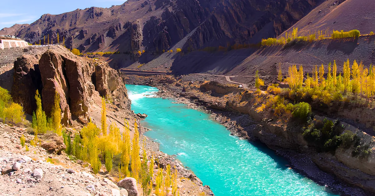
First, the Indus River takes a northwest direction through the Ladakh region. This is followed by the entry of the river into Pakistan through the Gilgit-Baltistan region.
Here, the Indus River takes a southward direction and passes through deep mountain gorges around Nanga Parbat.
Later on, the river passes through some important provinces, including Khyber Pakhtunkhwa, Punjab, and Sindh. The river has an overall length of about 3,180 kilometres. Ultimately, it reaches an endpoint through the formation of a large delta in Sindh.
What Are Its Major Tributaries?
The Indus River gets water from several important tributaries on its way down:
- Left Bank Tributaries (Eastern Rivers): Jhelum, Chenab, Ravi, Sutlej, and Beas. All these five rivers join in Panjnad to meet the main Indus River.
- Right Bank Tributaries (Western Rivers): Shyok, Gilgit, Hunza, Swat, Kabul, Kurram, and Gomal.
All these tributaries form an enormous Indus River Basin, covering about 1.12 million square kilometres. The river basin within Pakistan itself covers over 520,000 square kilometres. It comprises almost 65 percent of the total land area of Pakistan!
How Does the River Support Pakistan?
- The Indus River Basin Irrigation System: The Indus River supports the Indus Basin Irrigation System (IBIS). IBIS waters over 17 million hectares of agricultural land. That amounts to 80% of all the agricultural lands in Pakistan! This water supply helps farmers cultivate crops such as wheat, rice, sugarcane, and cotton.
- Environmentally Friendly Hydroelectric Power Supply: In 1976, the Tarbela Dam was constructed on the Indus River in Khyber Pakhtunkhwa. The Tarbela Dam is one of the world's biggest earth-filled dams, which stores up to 11 billion cubic meters of water and supplies power in the thousands of megawatts to industries and residential areas.
- Significant History: The river valley used to be home to the ancient Indus Valley civilisation more than 4,000 years ago.
- Significant Historical Treaty: In 1960, the Indus Waters Treaty was signed between India and Pakistan under the supervision of the World Bank.
Conclusion
The Indus River is indeed the true lifeblood of Pakistan in many aspects. The river provides sustenance to millions, water for urban cities, and electricity for the country. It is through this great river that the fertile plains of Punjab and Sindh would remain green; otherwise, they would have been transformed into barren deserts. The entire geography of Pakistan is defined by the Indus River from its icy source in Tibet to the Arabian Sea.

Kriti Barua is a skilled digital journalist and communications professional with 4+ years of experience, currently writing for the General Knowledge section at Jagran New Media. She has established herself as a subject matter expert in History, Geography, Trending National and International News, Sports, Science, and Defence, producing clear, reliable, and search-optimised content that connects with readers worldwide.
Kriti holds a BA degree from Delhi University and a one-year diploma in TV Production and Journalism, an academic background that adds research depth and strong storytelling instincts to her writing. Her experience spans brand writing, content marketing, and digital media, giving her a sharp understanding of what makes content both helpful to readers and visible in search.
At Jagran New Media, she applies this expertise to national and international news coverage, query-based articles, and in-depth pieces across her specialist subject areas. Her content is defined by easy language, factual accuracy, strong keyword strategy, and reader-friendly storytelling.