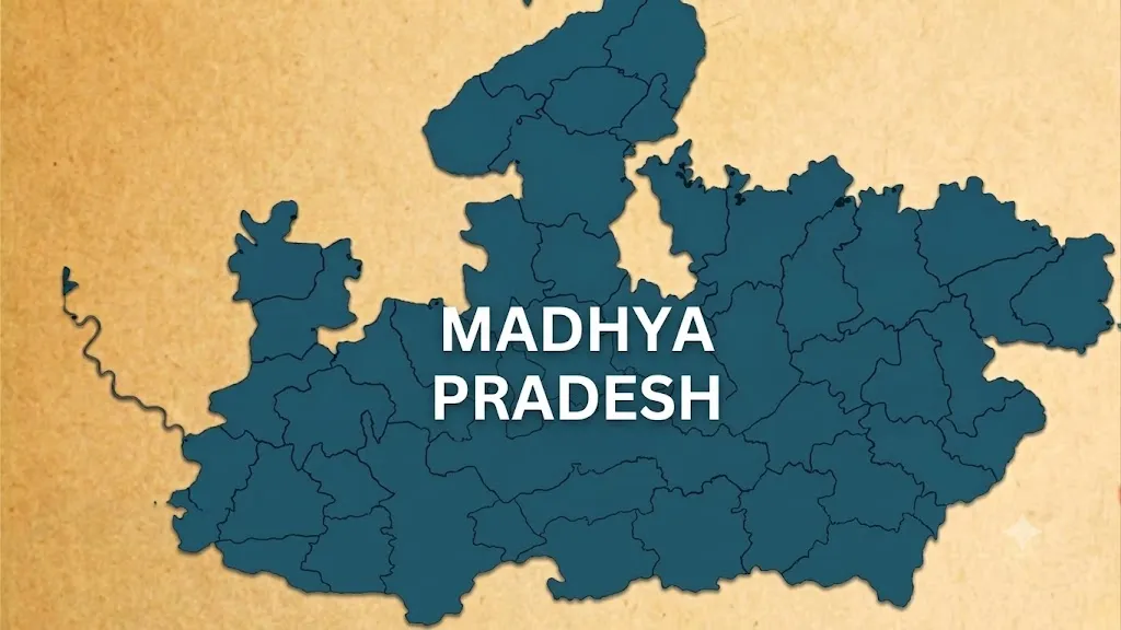
Chhindwara is the largest district in Madhya Pradesh by area, covering approximately 11,815 square kilometres. Located in the southern part of the state, Chhindwara is known for its forests, Satpura landscapes and agricultural activities.
Which Is the Largest District in Madhya Pradesh?
Chhindwara is the largest district of Madhya Pradesh by geographical area. It covers approximately 11,815 sq km. The district is located in the southern part of Madhya Pradesh. Chhindwara city is the district headquarters.
Related Stories
Where Is Chhindwara Located?
Chhindwara is situated in the southern part of Madhya Pradesh. It lies in the Satpura mountain region. The district shares boundaries with parts of Madhya Pradesh and Maharashtra. Its area includes forests, hills, valleys and agricultural land.
What Is the Area of Chhindwara District?
Chhindwara covers around 11,815 sq km. Its large geographical area makes it the largest district in Madhya Pradesh by area. The district has extensive forest areas.
What Is Chhindwara District Famous For?
Chhindwara is known for its natural landscapes and forests. The district has major agricultural activity. Corn (maize) is an important crop grown in the region.
Which Mountain Range Is Found in Chhindwara?
Chhindwara is part of the Satpura mountain region. The district has a largely hilly and forested landscape. The Satpura ranges have influenced the region’s climate and vegetation.
What Is the Headquarters of Chhindwara District?
Chhindwara city is the administrative headquarters of the district. It is an important urban centre in southern Madhya Pradesh. The city has served as a centre for administration, education and commerce. Chhindwara is connected with other major towns and cities through road and rail networks.
Key GK Facts About Chhindwara:
| Fact | Details |
| District | Chhindwara |
| State | Madhya Pradesh |
| Area | Approximately 11,815 sq km |
| District Headquarters | Chhindwara |
| Region | Satpura |
| Location | Southern Madhya Pradesh |
| Known For |
Forests, agriculture, and Satpura landscapes
|
Madhya Pradesh Districts List
h
| # | District | Population (2011) | Area (km²) |
| 1 | Agar Malwa | 5,71,278 | 2,785 |
| 2 | Alirajpur | 7,28,677 | 3,182 |
| 3 | Anuppur | 7,49,521 | 3,747 |
| 4 | Ashok Nagar | 8,44,979 | 4,674 |
| 5 | Balaghat | 17,01,156 | 9,229 |
| 6 | Barwani | 13,85,659 | 5,432 |
| 7 | Betul | 15,75,247 | 10,043 |
| 8 | Bhind | 17,03,562 | 4,459 |
| 9 | Bhopal | 23,68,145 | 2,772 |
| 10 | Burhanpur | 7,56,993 | 3,427 |
| 11 | Chhatarpur | 17,62,857 | 8,687 |
| 12 | Chhindwara | 20,90,306 | 11,815 |
| 13 | Damoh | 12,63,703 | 7,306 |
| 14 | Datia | 7,86,375 | 2,694 |
| 15 | Dewas | 15,63,107 | 7,020 |
| 16 | Dhar | 21,84,672 | 8,153 |
| 17 | Dindori | 7,04,218 | 7,427 |
| 18 | Guna | 12,40,938 | 6,485 |
| 19 | Gwalior | 20,30,543 | 5,465 |
| 20 | Harda | 5,70,302 | 3,339 |
| 21 | Hoshangabad | 12,40,975 | 6,698 |
| 22 | Indore | 32,72,335 | 3,898 |
| 23 | Jabalpur | 24,60,714 | 5,210 |
| 24 | Jhabua | 10,24,091 | 6,782 |
| 25 | Katni | 12,91,684 | 4,947 |