NASA and the Indian Space Research Organisation (ISRO) are embarking on a groundbreaking joint mission: the NASA-ISRO Synthetic Aperture Radar (NISAR) mission. Scheduled for launch in 2024, NISAR promises to be a game-changer in studying Earth's cryosphere, the realm of ice and snow covering glaciers, ice sheets, permafrost, and sea ice.
Before we learn about NISAR, let us first understand why studying the Cryosphere matters.
Why studying the Cryosphere is significant?
The cryosphere plays a crucial role in our planet's climate system. It acts as a giant water reservoir, holding about 70% of Earth's freshwater. Glaciers and ice sheets regulate sea levels, while snow cover reflects sunlight, influencing global temperatures. Understanding the changes in the cryosphere is therefore vital for predicting future climate patterns, rising sea levels, and the impact on ecosystems and human populations.
Also read: Which Is The Biggest Volcano In The Solar System And Why?
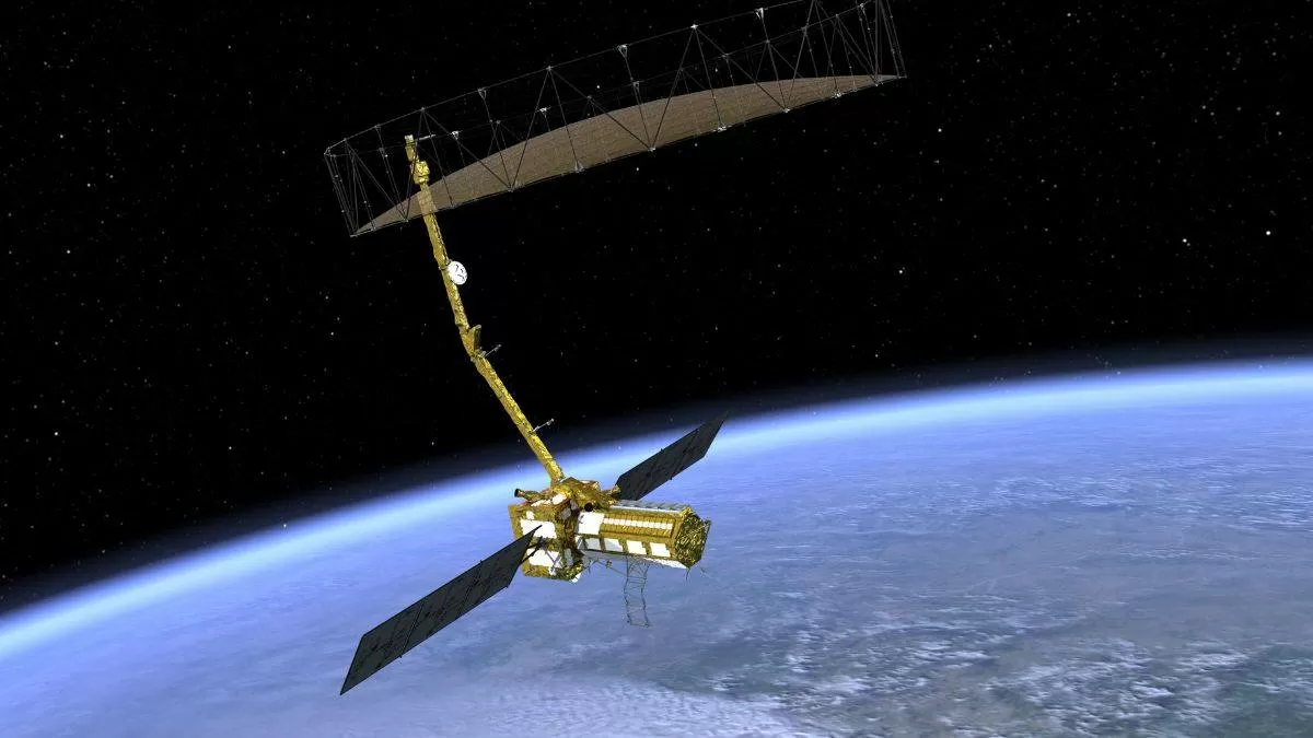
What is NISAR?
Short for NASA-ISRO Synthetic Aperture Radar (NISAR) is a radar satellite from NASA and the Indian Space Research Organisation (ISRO). NISAR will provide the most comprehensive picture to date of motion and deformation of frozen surfaces in Earth’s ice- and snow-covered environments, collectively known as the cryosphere.
Also read: China’s Spaceplane Mission: Know All Key Details and Its Significance Here
What will NISAR do?
This cutting-edge satellite will carry two powerful radar systems: an L-band radar, provided by NASA, and an S-band radar, developed by ISRO. As per the official website of NASA, NISAR will observe nearly all the planet’s land and ice surfaces twice every 12 days. The satellite’s unique insights into Earth’s cryosphere will come from the combined use of two radars: an L-band system with a 10-inch (25-centimeter) wavelength and an S-band system with a 4-inch (10-centimeter) wavelength.
The L-band radar penetrates deeper into snow and ice, revealing hidden layers and structures, while the S-band radar excels at capturing surface features and changes. NISAR will use radar to deepen our understanding of deforestation, shrinking glaciers, natural hazards, and other global vital signs.
Measure ice sheet thickness and stability: NISAR's high-resolution radar data will enable scientists to monitor the thickness and movement of glaciers and ice sheets, offering crucial insights into their contribution to sea level rise. As per NASA, Antarctica’s ice sheets hold the planet’s largest reservoir of frozen fresh water. NISAR’s orientation in orbit will enable it to collect data from Antarctica’s far interior, close to the South Pole – unlike other large imaging radar satellites.
Track changes in Earth’s mountain glaciers, snow cover and melt dynamics: The melting of the planet’s mountain glaciers has contributed about a 1/3rd of the sea level rise since the 1960s. The mission will track the extent and timing of snow cover, providing valuable data for understanding the impact of climate change on snowmelt and freshwater availability.
Map permafrost extent and stability: Permafrost, frozen ground in the Arctic and boreal regions, holds immense amounts of carbon. NISAR will monitor its thawing and potential release of greenhouse gases, further informing climate models.
Study the impact of natural hazards: The mission will provide detailed data on landslides, earthquakes, and volcanic eruptions, aiding in disaster preparedness and response. In the Himalayas, NISAR’s all-weather capability will help researchers monitor how much water is stored in glacial lakes, which is essential to assessing the risk of catastrophic floods.


-1766337791473.jpg)
Comments
All Comments (0)
Join the conversation