What is the Wallace Line?
The Wallace Line is an imaginary biogeographical boundary that separates the distinct faunal regions of Asia and Australasia. It was first proposed by Alfred Russel Wallace, a British naturalist, in the 19th century after he observed a sharp division in species distribution while travelling through the Malay Archipelago. Despite the close proximity of islands on either side, their flora and fauna differ significantly, highlighting the impact of historical geological and climatic changes on biodiversity.
Understanding the Wallace Line provides insight into evolutionary biology, species migration, and continental drift and remains a crucial concept in modern conservation and ecology.
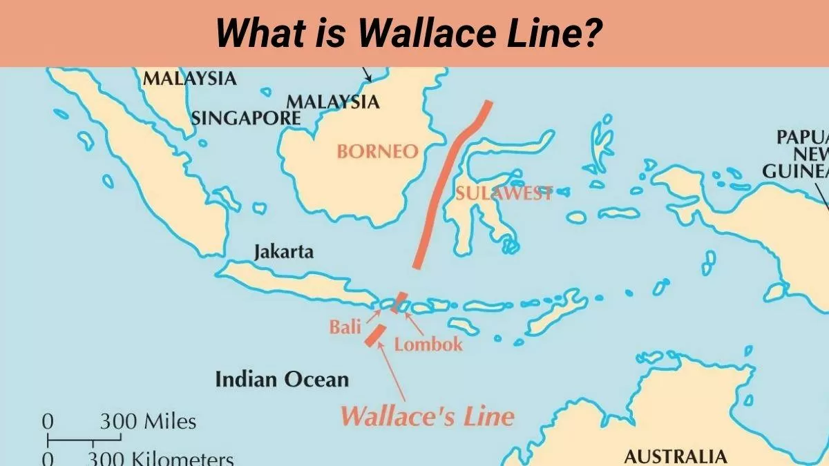
Location of the Wallace Line
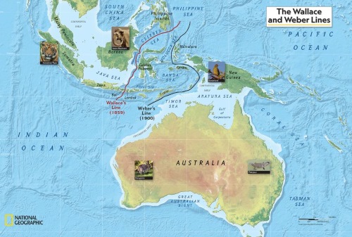
Source:education.nationalgeographic
The Wallace Line runs through the Malay Archipelago, marking a division between Asian and Australian species. It extends:
- Between the islands of Bali and Lombok
- Between Borneo and Sulawesi
- South of the Philippines (Mindanao region)
What are the features of Australasia (east of the line) that make it differ from Asia (west of line)?
The Wallace Line separates two distinct faunal regions, i.e., Australasia (east of line) and Asia (west of line), which hold both different species. While travelling through the Malay Archipelago, Wallace found a sharp contrast in species distribution, despite the islands being geographically close. His findings laid the foundation for modern biogeography, which studies how species are distributed across the planet.
| Feature | Asia (West of the Line) | Australasia (East of the Line) |
| Dominant Species | Tigers, Elephants, and orangutans | Kangaroos, Cockatoos, and Marsupials |
| Mammal Types | Placental Mammals (e.g., Monkeys) | Marsupials (e.g., Koalas, Wallabies) |
| Bird Species | Hornbills, Peafowls | Cockatoos, Cassowaries |
| Flora | Dense Tropical Rainforests | Eucalyptus and Acacia forests |
Wallace’s Observations and Findings
While conducting extensive fieldwork in Indonesia, Wallace noticed a dramatic shift in species composition, particularly on the island of Sulawesi, which contained an unusual mix of species from both regions. Some notable examples include:
| Species | Region of Origin |
| Tarsiers (small primates) | Asian origin |
| Lowland Anoa (Bubalus depressicornis) | Asian origin |
| Mountain Anoa (Bubalus quarlesi) | Asian origin |
| Dwarf Cuscus (Strigocuscus celebensis) | Australian origin (marsupial) |
What are the reasons behind the formation of the Wallace Line?
The formation of the Wallace Line can be explained by plate tectonics and climate change over millions of years:
- Continental
- Australia was once connected to Antarctica and began drifting northward around 50 million years ago.
- This movement led to the formation of Indonesia’s volcanic islands and created new land bridges and ocean barriers that influenced species migration.
- Isolation and
- As islands broke off from the Asian mainland, species on these islands became isolated and evolved independently.
- Over time, distinct ecosystems developed, leading to the unique biodiversity seen today.
- Climate and Migration
- A 2023 study analysing 20,000 species found that Asian species migrated more easily due to warmer and wetter tropical conditions in the northern islands.
- Australian species faced difficulties migrating northward as they were adapted to cooler and drier climates.
- Migration pathways for Australian species emerged much later—only a few million years ago, making their spread into Asia more challenging.
Thus, the Wallace Line is not a fixed boundary but a reflection of deep evolutionary and geological forces that shaped life in the region.
Why is the Wallace Line important and still matters today?
The Wallace Line has significant implications for evolution, ecology, and conservation.
1. Understanding Evolutionary Biology
- The Wallace Line supports Charles Darwin’s theory of evolution, showing how species adapt to their environments over time.
- It proves that geographical barriers influence the distribution of life, shaping ecosystems over millions of years.
2. Insights into Species Migration
- It demonstrates how climate, ocean currents, and geography determine species movement.
- Explains why similar ecosystems on both sides of the line contain entirely different species.
3. Conservation and Biodiversity Protection
- The Indo-Malayan region has one of the world’s highest rates of habitat destruction due to deforestation, urbanisation, and climate change.
- Understanding past migration patterns helps predict how species will respond to environmental changes today.
Contemporary Relevance: The Future of Wallace’s Research
New technologies such as computer simulations, genetic studies, and climate modelling continue to refine our understanding of the Wallace Line:
🔹 Biogeographical Models: Advanced evolutionary modelling helps scientists track species movements and predict future biodiversity shifts.
🔹 Genetic Research: DNA sequencing reveals hidden evolutionary connections between species across the Wallace Line.
🔹 Conservation Strategies: Studying ancient migration patterns helps in designing effective conservation policies to protect endangered species.
Scientists now view the Wallace Line as a flexible boundary rather than a rigid line, recognising that species dispersal is complex and constantly evolving.
Conclusion
The Wallace Line is a testament to the power of geography, climate, and evolution in shaping Earth's biodiversity. While it may appear as a simple boundary, it represents millions of years of continental drift, species adaptation, and climate change.
As habitat destruction accelerates and global temperatures rise, the lessons from the Wallace Line will be critical for protecting ecosystems and ensuring the survival of unique species. Understanding this historic boundary is not just about science but about safeguarding the future of biodiversity on our planet.


Comments
All Comments (0)
Join the conversation