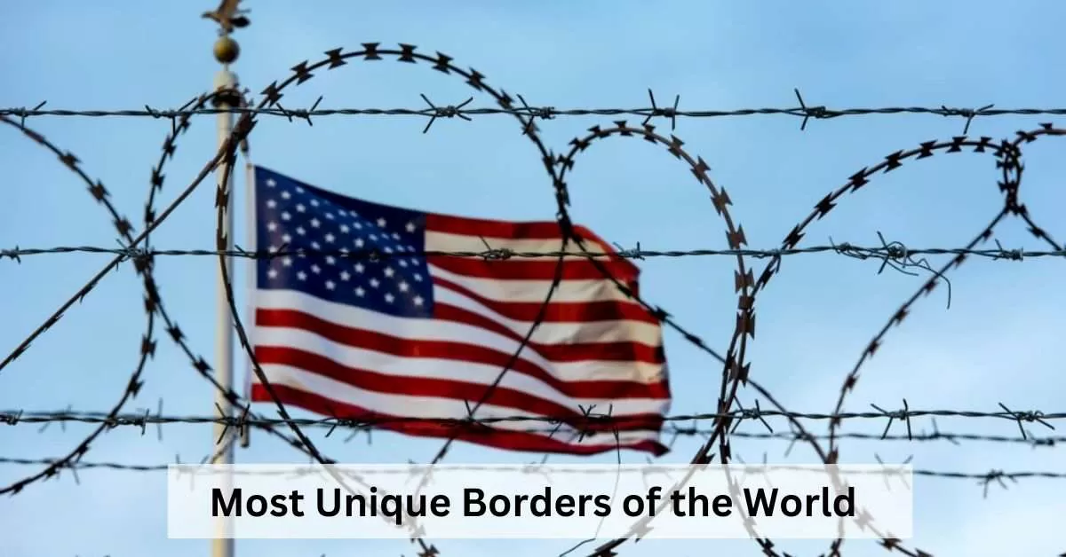
From the shortest land border in the world to the most heavily fortified, there are many unique borders around the globe.
Some of these borders are defined by natural features, such as rivers or mountains, while others are marked by artificial structures, such as fences or walls. Still others are simply invisible lines drawn on a map.
Here are 9 most unique borders of the world:
- Penon de Velez de la Gomera, Spain
- San Marino-Italy
- Slovakia-Austria-Hungary
- Nepal-China
- Lesotho-South Africa
- United States-Canada
- Spain-Portugal
- Haiti-Dominican Republic
- North Korea-South Korea
1. Penon de Velez de la Gomera, Spain
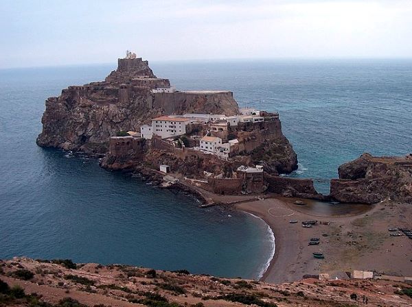
Source: Wikipedia
Penon de Velez de la Gomera is a tiny Spanish exclave located on the coast of Morocco, just 100 meters from the African mainland.
It is the smallest Spanish territory and has a population of just 60 Spanish soldiers. The exclave is a remnant of the Spanish presence in North Africa, which dates back to the 15th century.
The border between Penon de Velez de la Gomera and Morocco is the shortest land border in the world, measuring just 86 metres long.
The border is marked by a fence and a gate, and it is guarded by Spanish soldiers. The border is also closely monitored by Spanish and Moroccan naval vessels.
The exclave's strategic location has made it a source of tension between Spain and Morocco for centuries. Morocco has repeatedly claimed the exclave as its own, but Spain has refused to cede it.
The exclave is also a popular target for illegal immigration from Africa to Europe.
In recent years, the exclave has become a tourist destination, with visitors drawn by its unique history and location.
However, tourism is limited due to the exclave's small size and military presence.
2. San Marino-Italy
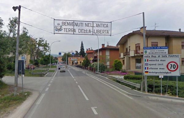
Source: Reddit
The border between San Marino and Italy is marked by a series of stones and fences. It is one of the most unique borders in the world, as it is completely surrounded by another country.
The border is also relatively short, measuring just 39 kilometres long.
The San Marino-Italy border is crossed by a number of roads and railways. The most important border crossing is the Dogana border crossing, which is located on the main road between Rimini and Florence.
The Dogana border crossing is open 24 hours a day, and there are no passport controls for citizens of the European Union.
San Marino is a popular tourist destination, and the border crossing is often busy during the summer months.
Visitors to San Marino can enjoy the country's medieval hilltop capital city, its beautiful scenery, and its unique culture.
3. Slovakia-Austria-Hungary
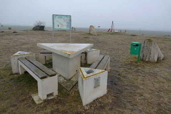
Source: Bjorn Free
The border between Slovakia, Austria, and Hungary is a unique tripoint border. It is marked by a triangular table with three seats, one for each country.
The table is located in the middle of a forest, and it is a popular spot for tourists to take photos.
The tripoint is located in the Bratislava Region of Slovakia, about 10 kilometres from the Austrian town of Kittsee and the Hungarian town of Rajka.
The table is made of wood and is painted in the colours of the three countries' flags. It is surrounded by trees and has a view of the surrounding countryside.
The Tripoint is a popular tourist destination, as it is one of the few places in the world where visitors can stand in three different countries at the same time.
The site is also popular with cyclists and hikers, as it is located on a number of cycling and hiking trails.
The tripoint was established in 1920, after the collapse of the Austro-Hungarian Empire. The three countries agreed to share the territory of the former empire, and the tripoint marks the point where their borders meet.
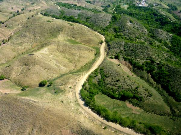
4. Nepal-China
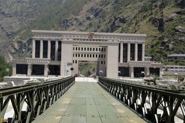
Source: The Kathmandu Post
The border between Nepal and China is one of the highest borders in the world, with an average elevation of over 5,000 meters. It is also one of the most remote and inaccessible borders in the world, with much of it running through the Himalayas.
The border is marked by a series of mountain peaks, including Mount Everest, the highest mountain in the world. The border is also marked by a number of rivers and glaciers.
The Nepal-China border is approximately 1,414 kilometres long and is divided into three sections: the western, central, and eastern sections.
The western section of the border is the most challenging to access, as it runs through some of the highest and most rugged terrain in the world. The central section of the border is more accessible, but it is still very remote. The eastern section of the border is the most accessible, and it is where the majority of trade and travel between Nepal and China takes place.
5. Lesotho-South Africa
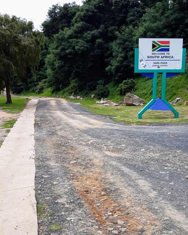
Source: Wikimedia Commons
The border between Lesotho and South Africa is approximately 911 kilometres long and is marked by a series of fences and gates. The border is also marked by a number of rivers and mountains.
The Lesotho-South Africa border is a very important border for both countries. It is a major trade route between the two countries, and it is also a popular tourist destination.
The border is also a strategic border, as it lies between two countries with very different political and economic systems.
The Lesotho-South Africa border has been the subject of dispute between the two countries in the past. In 1975, South Africa annexed the small Lesotho exclave of Qacha's Nek, but it returned the territory to Lesotho in 1990.
6. United States-Canada
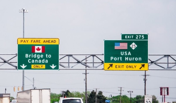
Source: CAA South Central Ontario
The border between the United States and Canada is the longest land border in the world, measuring over 8,800 kilometres long. The border is marked by a variety of features, including fences, rivers, and lakes.
The border is divided into nine sections, each of which is patrolled by a different US Border Patrol sector or Canadian Border Services Agency district.
The border is also monitored by a variety of electronic surveillance systems.
The US-Canada border is a major trade route between the two countries. It is also a popular tourist destination, with millions of people crossing the border each year.
The border is also a strategic border, as it lies between two nuclear-armed powers. The border has been the subject of some disputes between the two countries over the years, but these disputes have generally been resolved peacefully.
7. Spain-Portugal
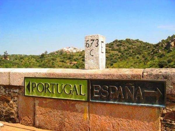
Source: Schengen Visa
The border between Spain and Portugal is one of the oldest borders in the world, dating back to the 12th century.
It is also one of the longest borders in Europe, measuring over 1,200 kilometres long. The border is marked by a series of stones and fences, as well as a number of border markers.
The Spain-Portugal border has been the subject of dispute between the two countries for centuries. In the 13th century, the two countries signed the Treaty of Alcañices, which established the current border. However, there are still some areas of the border that are contested.
8. Haiti-Dominican Republic
Source: UNEP
The border between Haiti and the Dominican Republic is one of the most dangerous borders in the world. It is marked by a series of fences and gates, but it is also porous and easy to cross illegally. The border region is plagued by poverty, violence, and crime.
There are a number of factors that contribute to the dangerous nature of the Haiti-Dominican Republic border.
One factor is the economic disparity between the two countries. Haiti is one of the poorest countries in the world, while the Dominican Republic is a relatively prosperous country.
This economic disparity leads many Haitians to try to cross the border illegally in search of better opportunities.
9. North Korea-South Korea
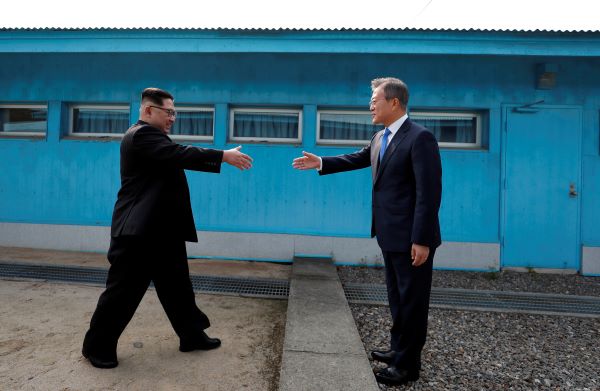
Source: NBC News
The Demilitarized Zone (DMZ) is a 250-kilometer-long strip of land that divides North and South Korea.
It is one of the most heavily fortified borders in the world, with both sides maintaining large armies and military installations.
The DMZ is also one of the most dangerous borders in the world, with occasional skirmishes and incidents of violence.
The DMZ was created in 1953 as part of the armistice agreement that ended the Korean War. The DMZ is four kilometres wide at its narrowest point and 250 kilometres long.
It is divided into three sections: the Joint Security Area (JSA), the Northern Limit Line (NLL), and the Southern Limit Line (SLL).
The JSA is a one-kilometre-wide strip of land in the centre of the DMZ. It is the only place where North and South Korean troops stand face-to-face.
The JSA is also the site of the Panmunjom Joint Security Area (PJA), where North and South Korea hold talks and negotiations.


Comments
All Comments (0)
Join the conversation