India's coastline has grown by over 50% in length during the past few decades. This growth has been brought about by more precise measurements that have been taken recently. Any territorial acquisition was not a part of it.
Furthermore, India now has a slightly larger number of islands. This increase is the result of India's reexamination and recount of its offshore islands. From an administrative and strategic standpoint, the expansion of the coastline and the number of islands is remarkable and significant. However, the situation on the ground has not changed.
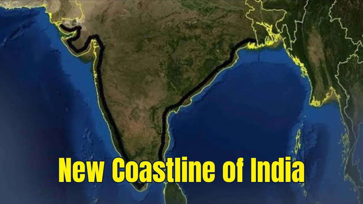
Why India’s Coastline Length Has Increased
In the 1970s, India’s coastline was measured as 7,516 kilometers. But now, the latest measurement shows it as 11,098 kilometers, which is an increase of 3,582 kilometers (almost 48% more).
This big change has not happened because the land has changed. It happened because the way of measuring improved with the evolving technology.
Reason Behind the Change
-
In the early days, the coastline measurement was done on a small scale, 1:4,500,000.
-
This scale was not detailed and missed many small bends and curves.
-
Now, the measurement is done on a larger and clearer scale, 1:250,000, which shows a more detailed structure and measurement.
State-wise Indian Coastline
The table below shows the coastline length of Indian states and union territories as per the latest measurements:
| State/UT | Coastline Length (in km) |
| Gujarat | 2,340.62 |
| Maharashtra | 877.97 |
| Goa | 193.95 |
| Karnataka | 343.30 |
| Kerala | 600.15 |
| Tamil Nadu | 1,068.69 |
| Andhra Pradesh | 1,053.07 |
| Odisha | 574.71 |
| West Bengal | 721.02 |
| Daman and Diu | 54.38 |
| Pondicherry | 42.65 |
| Lakshadweep | 144.80 |
| Andaman and Nicobar | 3,083.50 |
Source: Ministry of Ports, Shipping and Waterways
How Scale Affects Coastline Measurement
Coastlines are extremely unpredictable formations. Reducing the measurement ruler is equivalent to increasing the data's resolution. For instance, many minor abnormalities in the ground structure that a one-meter ruler can chart will be missed by a one-kilometer ruler. More detailed images of the coastline's bends and curves can be obtained using higher resolution data. These minute details become smoothed down and show up as straight lines in low-resolution data.
The length would be shortened by the removal of bends and curves. Additionally, the earlier estimate came from laborious and more traditional computations. These have since been supplanted by more recent GIS tools, which can much more precisely depict the continents' imperfections.
Addition of Offshore Islands
The earlier measurements were done using traditional and manual methods, which were less accurate. Today, with the help of modern tools like GIS (Geographic Information Systems) and high-resolution satellite images, it is possible to map the coastline much more accurately. These tools capture every small detail of the land.
Another reason for the increase in coastline length is that the coastlines of many small offshore islands have now been included in the latest calculations. Earlier, because of limited technology and smaller-scale data, many of these islands were either missed or not counted.
ALSO READ: Will You Have to Pay MORE for Your Railway Tickets? Check Details Here
What is the Coastline Paradox
Even with the latest technology, the true length of any coastline, including India’s, can never be exactly fixed. This is known as the coastline paradox. The more closely you try to measure the coastline, the longer it becomes because you keep finding smaller and smaller bends and edges. This is a natural problem when measuring irregular shapes like coastlines.
This same problem doesn’t just apply to coastlines. It also affects natural features like river systems and mountain ranges. Rivers do not flow in straight lines, and their banks are highly uneven. If you try to measure along the riverbanks, you will face the same issue as measuring coastlines. However, river lengths are usually measured along the main stream, which avoids some of this problem.
ALSO READ: RailOne Indian Railway Super App: How to Download, Key Features and Benefits
Regular Measurement Needed
As technology continues to improve, measurements will become even more detailed, and the reported length of the coastline may increase again. This is why experts now suggest that this measurement process should be repeated every 10 years to keep the data accurate and updated.


Comments
All Comments (0)
Join the conversation