What is the origin of the Indus River system?
The Indus River is one of Asia's longest river systems. It originated in Mansarovar in Tibet at an elevation of 5182 metres and flows about 2880 km. The Indus River is part of the Himalayan River System, which comprises the Ganga and the Brahmaputra. These Himalayan rivers have existed even before the formation of the Himalayas. As for origin, these rivers were present even before the Indian Plate and Eurasian Plate collided.
Source: indiawris.gov.in
In this article, we will explore the Indus River in detail, its tributaries, and all about its civilisation.
Also Read: What is the Indus Water Treaty? Check the history and significance of this agreement
Also Read: History of Pakistan Occupied Kashmir (POK)
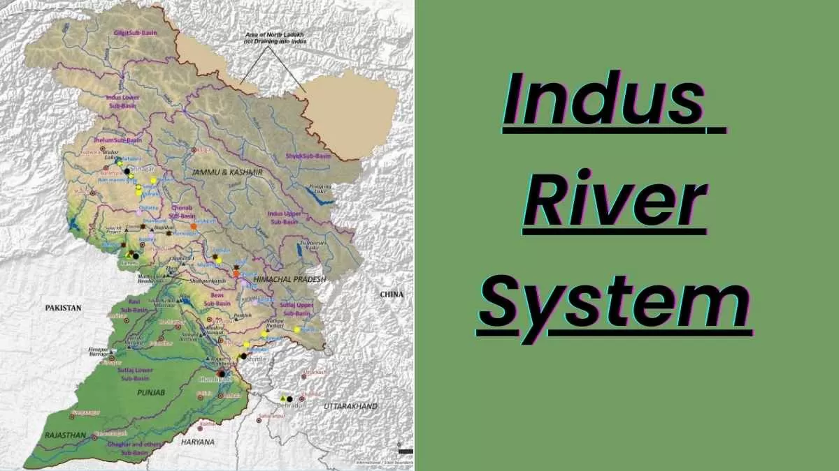
Indus River Drainage System
| Indus Different Names | Languages in which the Indus River is known |
| Sindhu | Sanskrit |
| Sinthos | Greek |
| Sindus | Latin |
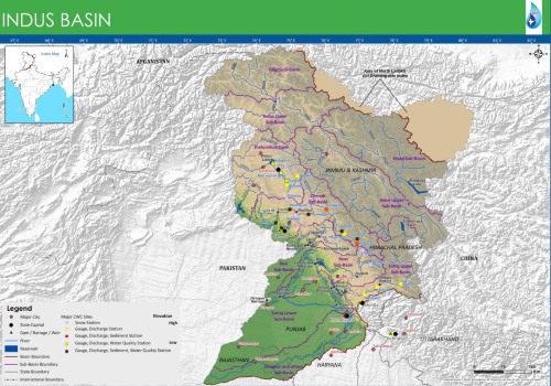
The Indus River Basin extends from Tibet (China) and India to Afghanistan and Pakistan, covering an area of about 11,65,500 sq. km. In India, it covers almost all of Jammu & Kashmir, Himachal Pradesh, Punjab, Rajasthan, Haryana, and Chandigarh. It is almost 2880 km, and in India, its length is almost 1,114 km. The Indus River Basin is surrounded by the Himalayas in the east, by the Karakoram range and Haramosh range from the north, and by the Sulaiman and Kirthar ranges from the west, and in the south it is covered by the Arabian Sea.
It flows in a northwest direction from its source, Mansarovar Lake, till it reaches up to the Nanga Parbat Range.
Indus River Civilisation
The Indus River system played a very important role in the development of ancient civilisations, including the Indus River civilisation. As we know, the Indus River civilisation is the oldest in the world and is the earliest urban culture of the northwestern region of the Indian subcontinent. It is one of the oldest civilisations among the Mesopotamians and Egyptians. It is approximately dated from 3300 BCE to 1300 BCE. Many sites were discovered from this civilisation, like the Harappa civilisation and Mohenjo-Daro.
What are the salient features of the Indus River System?
| Salient Features of Indus Basin (Upto border) | |
| Basin Extent Longitude Latitude | 72° 28’ to 79° 39’ E 29° 8’ to 36° 59’ N |
| Length of Indus River (Km) | 1114 (in India) |
| Catchment Area (Sq.km.) | 321289 |
| Average Water Resource Potential (MCM) | 73310 |
| Utilizable Surface Water Resource(MCM) | 46000 |
| Live Storage Capacity of Completed Projects (MCM) | 16222.0 |
| Live Storage Capacity of Projects Under Construction (MCM) | 100.00 |
| Total Live Storage Capacity of Projects (MCM) | 16322.00 |
| No. of Hydrological Observation Stations of CWC | 26 |
| No. of Flood Forecasting Stations of CWC | 0 |
Physiography of the Indus River System
The Indus River Basin is covered by an area of 11,65,500 sq km, which lies in Tibet, India, Afghanistan, and Pakistan. Below in the table, the Indus River flows through how many states and is given with their drainage area:
| State | Drainage area (sq. km) |
| Jammu and Kashmir | 193,762 |
| Himachal Pradesh | 51,356 |
| Punjab | 50,304 |
| Rajasthan | 15,814 |
| Haryana | 9,939 |
| Chandigarh | 114 |
| Total | 321,289 |
Tributaries Of the Indus River System
The Indus River System comprises a total of 5 rivers that are the Jhelum River, Chenab River, Ravi River, Beas River, and Satluj River.
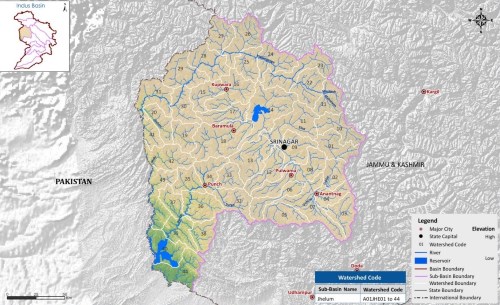
1. Jhelum River:
Source: indiawris.gov.in
Jhelum originates from Verinag in the south-eastern part of the Kashmir Valley. It flows from northward toward Wular Lake; from here it changes its course toward southward and flows into the hill of Baramulla. From here, it takes steep-sided, narrow paths through the Pir Panjal range. The Jhelum River makes a zig-zag curve at Muzaffarabad, and from here it makes a 170 km border between India and Pakistan before emerging with the Potwar Plateau.
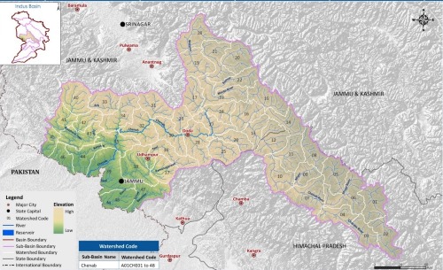
2. Chenab River:
Source: indiawris.gov.in
The Chenab River originates from the Bara Lacha Pass in the Lahul Spiti, which is a part of the Zanskar Range. After the merging of the two rivers, Chandra and Bhaga, at Tandi, the Chenab River is created. The Chenab River is also known as Chandrabhaga. On this river only, the world’s tallest rail bridge was constructed.
3. Ravi River:
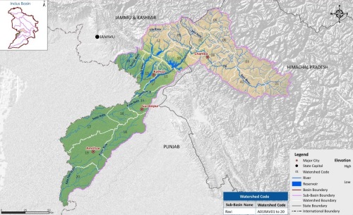
Source: indiawris.gov.in
The Ravi River originates from the Kullu Hills in the Rohtang Pass in Himachal Pradesh. The Ravi River generally drains in the area between the Pir Panjal and Dhaola ranges. It takes the southwest after crossing the Chamba district and reaches the Punjab plains before moving to Pakistan below Amritsar.
4. Beas River:
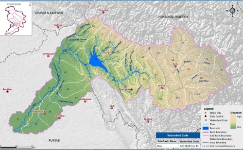
Source: indiawris.gov.in
The Beas River originates from the Rohtang Pass on the southern end of the Pir Panjal Range, which is close to the source of the Ravi River. It takes a south-western direction and travels through the Dhaola Dhar range, and from there, in Lake Harike, Punjab, it meets with the Satluj River before flowing into Pakistan.
5. Staluj River
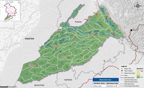
Source: indiawris.gov.in
Satluj River, sometimes also referred to as the Red River, originates from the southern slopes of the Kailash Mountain near Mansarovar Lake and Rakas Lake. Before entering the Shipki La, it travels through different districts of Himachal: Kinnaur, Shimla, Kullu, Solan, Mandi, and Bilaspur. In Himachal, after Shipli La, it enters into Punjab plains near Bhakra, and here only the world’s highest gravity dam is constructed on this river only, which is the Bhakra Nangal Dam.
Conclusion
So, this is all about the Indus River system, which plays an important role in India's economy and agriculture. As it has five tributaries that are the Jhelum River, Chenab River, Ravi River, Beas River, and Staluj River, which mainly flow through the northern part of India, there are many hydroelectric dams constructed, which enable India to generate electricity.


Comments
All Comments (0)
Join the conversation