India–Pakistan border: The India–Pakistan border is officially called the Radcliffe Line, named after Sir Cyril Radcliffe, the British lawyer who demarcated it in 1947 during the partition of British India. This historic boundary separates the two nations and has witnessed significant political, social, and military events over the decades. The Radcliffe Line not only marks a physical division but also represents a defining moment in South Asian history when two independent countries, India and Pakistan, emerged. Today, it serves as a reminder of the struggles, sacrifices, and resilience of millions affected by the partition.
Origin and Naming of the Radcliffe Line
The Radcliffe Line was named after Sir Cyril Radcliffe, who was tasked with the challenging responsibility of drawing the boundary between India and Pakistan. Surprisingly, Radcliffe had never visited India before being appointed and had limited knowledge of the complex social, religious, and cultural fabric of the region. Despite the immense pressure, he completed the task in just five weeks, dividing the provinces of Punjab and Bengal based on religious demographics while attempting to minimise conflict. The name “Radcliffe Line” has since become synonymous with one of the most significant and controversial borders in modern history.
Length of the India–Pakistan Border
The India–Pakistan border stretches over approximately 3,323 kilometers, making it one of the longest international borders in the world. It traverses several Indian states, including Jammu and Kashmir, Punjab, Rajasthan, and Gujarat, each of which has its unique geographical features and strategic importance. Jammu and Kashmir is the northernmost section, characterised by rugged mountains and the sensitive Line of Control. Punjab, with fertile plains, is heavily populated and culturally significant, while Rajasthan and Gujarat comprise deserts and coastal areas, respectively. The diversity of the terrain along the border has influenced security measures, trade, and diplomatic relations between the two countries.
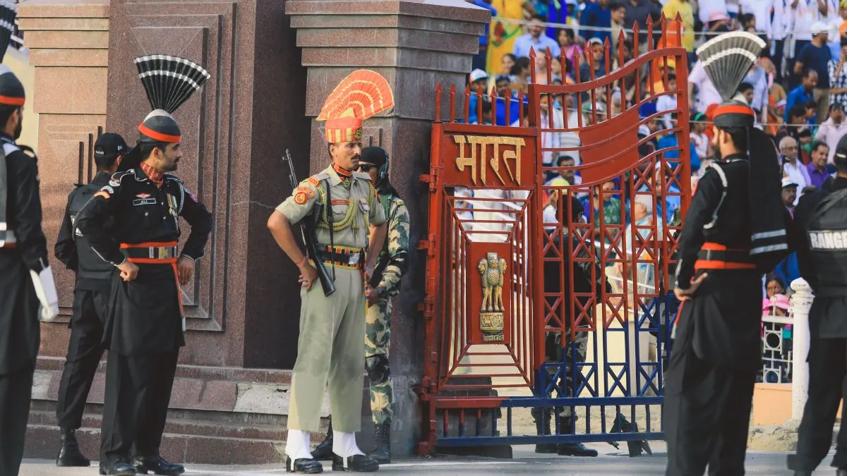
Wagah–Attari Border
The Wagah–Attari Border is the most celebrated point along the India–Pakistan border, located near Amritsar in India and Lahore in Pakistan. It is internationally famous for the daily Wagah Border Ceremony, a synchronised military parade performed by soldiers of both nations. This event draws thousands of visitors every day and showcases a display of discipline, patriotism, and rivalry in a ceremonial spirit. Beyond the spectacle, the Wagah–Attari Border serves as a key crossing point for trade, travel, and cultural exchanges between India and Pakistan, making it a symbol of both division and connection.
Types of Borders Between India and Pakistan
•International Border (IB): The officially recognised boundary separating India and Pakistan.
•Line of Control (LoC): The military control line dividing Indian-administered and Pakistan-administered areas in Jammu and Kashmir.
•Working Boundary: The border between Pakistan’s Punjab Province and Indian-administered Jammu region.
Historical Significance of the Radcliffe Line
The Radcliffe Line is historically significant as it represents the partition of India in 1947, an event that reshaped South Asia’s political and cultural landscape. The partition led to the creation of two sovereign nations, India and Pakistan, and triggered one of the largest migrations in human history, with millions crossing borders amid widespread violence.
Read more: Which is the Only Continent That Lies in All Four Hemispheres?


Comments
All Comments (0)
Join the conversation