NASA-ISRO Synthetic Aperture Radar (NISAR) has marked an history and become the first satellite that is jointly developed by ISRO and NASA. NISAR is launched aboard ISRO’s GSLV-F16 rocket on July 30, 2025, at 5:40 PM IST from the Satish Dhawan Space Centre (SDSC SHAR), Sriharikota. After the launch of the NISAR, this satellite will be placed in a Sun-synchronous orbit at an altitude of 747 km with an inclination of 98.40 degrees.
LIVE: We're launching an Earth-observing satellite with @ISRO to map surface changes in unprecedented detail. NISAR will help manage crops, monitor natural hazards, and track sea ice and glaciers.
— NASA (@NASA) July 30, 2025
Liftoff from India is scheduled for 8:10am ET (1210 UTC). https://t.co/M5cECyAAFg
On the launnched of the NISAR satellite, Dr Jitendra Singh, Union MoS(Ind. Charge)Science & Technology; Earth Sciences has tweeted on X.com,
Congratulations India!
— Dr Jitendra Singh (@DrJitendraSingh) July 30, 2025
Successful launch of #GSLV-F16 carrying the world’s first dual-band radar satellite #NISAR…a game changer in precise management of disasters like cyclones, floods etc. Also, it’s capacity to penetrate through fogs, dense clouds, ice layers etc make it a… pic.twitter.com/YbL4kFmVoA
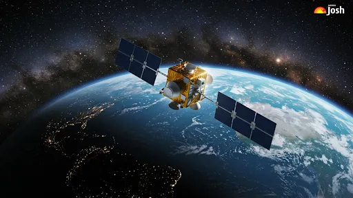
It’s the world’s first mission to use dual-frequency Synthetic Aperture Radar (SAR), which combines NASA’s L-band and ISRO’s S-band radars that are mounted on NASA’s 12-meter deployable mesh reflector, and the NISAR will be integrated into ISRO’s modified I3K satellite platform. NISAR will also be using advanced SweepSAR technology so that this satellite will be able to scan a swath width of 242 km with remarkable spatial resolution.
The NASA-ISRO Synthetic Aperture Radar (NISAR) mission is a pioneering Earth observation project developed jointly by the Indian Space Research Organisation (ISRO) and the National Aeronautics and Space Administration (NASA). It’s the first mission of its kind to use a dual-frequency Synthetic Aperture Radar (SAR) system—operating in both L-band and S-band frequencies—for global monitoring of Earth’s surface.

Source: ISRO
Mission Timeline
1. Launch Phase:
NISAR is launched on July 30, 2025, aboard a GSLV-F16 rocket from the Satish Dhawan Space Centre (SDSC), Sriharikota.
2. Deployment Phase:
Once in orbit, the massive 12-meter reflector antenna will be deployed via a complex boom system developed by NASA’s JPL.
3. Commissioning Phase:
The first 90 days post-launch will be dedicated to system checks and calibration—ensuring that both NASA’s and ISRO’s systems are functioning optimally.
4. Science Operations Phase:
Following successful commissioning, full science operations will commence. This includes regular orbital maneuvers and coordinated observation planning to avoid interruptions. Continuous calibration and validation activities will be carried out throughout the mission.
What are the objectives of NISAR?
NISAR is designed to provide detailed high-resolution data that will help scientists across the globe study dynamic Earth processes. The NISAR satellite is designed to observe the Earth in both daytime and nighttime, and this could be possible in any weather conditions. The satellite will revisit the same location every 12 days. Its precision will help scientists monitor minute changes in Earth’s surface—like ground shifts, glacier movements, and forest health. It also holds immense value for applications such as sea ice tracking, ship detection, storm monitoring, soil moisture mapping, water resource tracking, and natural disaster management.
With the ability to capture full polarimetric and interferometric data, the mission will:
-
Monitor changes in forests by measuring woody biomass
-
Track crop area and health over time
-
Map and study wetlands and their seasonal shifts
-
Observe and understand movements in glaciers and ice sheets across Greenland and Antarctica
-
Detect land surface changes caused by earthquakes, landslides, volcanic activity, and subsurface shifts like groundwater depletion or hydrocarbon extraction
What are the major characteristics of NISAR, the joint mission of NASA and ISRO?

Major characteristics of NISAR, the joint mission of NASA and ISRO, are:
| Mission Feature | Details |
| Mission Type | Collaborative Earth observation mission by ISRO and NASA |
| Satellite Platform | ISRO’s I-3K bus structure; Approx. 2400 kg at liftoff; 70V electrical bus |
| Stabilization | Fully 3-axis stabilised system |
| Main Payload | Dual-frequency Synthetic Aperture Radar (SAR) using L-band (NASA) and S-band (ISRO) |
| Antenna System | 12-meter wide deployable reflector on a 9-meter boom |
| Imaging Capability | Observes ~240 km swath; resolution ranges from 5 to 100 meters |
| Data Policy | Data will be freely and openly available to users |
| Orbit Type | Sun-synchronous, polar orbit with a 6:00 PM local time of crossing |
| Orbit Altitude | 747 km (circular orbit) |
| Orbital Inclination | 98.405 degrees |
| Weighing | 2392 kg |
| Launch Vehicle | ISRO’s GSLV Mk-II with a 4-meter payload fairing |
| Expected Mission Life | Designed to operate for at least 5 years |
How is the NISAR satellite configured for the spacecraft?
The satellite uses advanced SweepSAR technology for wide-area, high-resolution imaging. It will revisit the same global areas every 12 days, enabling scientists to track even minute changes in Earth's surface. Here are all the details given below:
-
The spacecraft is built on ISRO’s I-3K platform.
-
It carries two key radars: L-band and S-band SAR.
-
ISRO developed the S-band radar, data systems, spacecraft, and launch vehicle.
-
NASA provided the L-band radar, recorder, GPS, and a 9 m boom for a 12 m reflector.
-
ISRO handles satellite control; NASA manages radar operations and orbital planning.
-
Ground stations from both agencies support data reception and image downloads.
-
The combined L- and S-band data help track Earth changes like land shifts, ice movement, and forest cover.

Source: ISRO
How did NASA-ISRO develop the journey of the NISAR satellite?
The development of the NISAR mission, a joint mission of NASA and ISRO to develop an advanced satellite, has taken nearly a decade. Both radars that will be used in the NISAR satellite were built and tested independently by both space agencies. NASA handled the L-band SAR at the Jet Propulsion Laboratory (JPL), and ISRO developed the S-band SAR in India. The Integrated Radar Instrument Structure (IRIS), which houses both radars, was assembled and tested at JPL before delivery to ISRO. The final spacecraft integration and system-level testing were completed at ISRO's UR Rao Satellite Centre.

Source: ISRO
Conclusion
The NISAR mission, which is a joint mission of NASA-ISRO, will mark a significant leap in Earth observation capabilities. By offering global, frequent, and high-resolution data, it will make for a deeper understanding of the environmental changes, natural disasters, agriculture, and climate dynamics. It exemplifies international scientific cooperation at its best analysis for future prediction, also if anything happens in climate or natural hazard, bringing together the technological expertise of NASA and ISRO for a mission that will benefit the entire planet. This mission represents over a decade of collaboration between ISRO and NASA/JPL teams, showcasing a powerful partnership in space exploration and Earth science.


Comments
All Comments (0)
Join the conversation