According to the India Meteorological Department (IMD), a low-pressure area has been created in the east-central Bay of Bengal.
This would eventually move northwestward and is expected to highly intensify into a possibly severe cyclone storm by October 23, 2024. The storm is expected to make landfall in the state of Odisha.
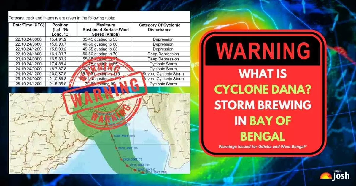
Cyclone Dana is set to make landfall along the Odisha-West Bengal coast between Puri and Sagar Island on the night of October 24 and early morning of October 25. This could result in widespread damage and flooding in the region.
The government has already issued warnings and advisories to the residents in the potential impact areas, urging them to take necessary precautions and evacuate if necessary.
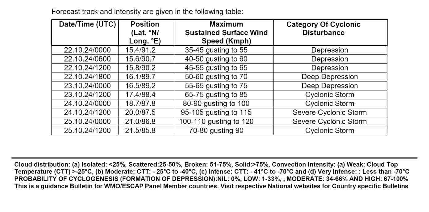
What is Cyclone Dana? Formation, Meaning Behind the Name, Date, Peak Intensity
Cyclone Dana is a severe cyclonic storm forming over the Bay of Bengal, expected to impact the coasts of Odisha and West Bengal in India.
The India Meteorological Department (IMD) has predicted that it will make landfall between Puri, Odisha, and Sagar Island, West Bengal, during the night of October 24 and the morning of October 25, 2024.
Formation
Current Status: Cyclone Dana is expected to develop from a low-pressure area in the Bay of Bengal, intensifying into a cyclonic storm by October 23, 2024. It is projected to reach the northwest Bay of Bengal near the Odisha-West Bengal coasts by the morning of October 24.
Meaning Behind Name
Cyclone Dana, named by Qatar, carries the meaning of "generosity" in Arabic. The name also symbolises "the most perfectly sized, valuable, and exquisite pearl" in Arabic.
It reflects cultural significance, particularly in regions known for pearl diving, such as the Arab states of the Persian Gulf. In Persian, "Dana" can also mean "wise" or "knowledgeable."
The WMO uses a rotating list of names contributed by member countries in the North Indian Ocean region.
This naming practice helps to streamline communication about storm tracking and public safety measures. As Cyclone Dana approaches, residents in the affected regions are urged to stay informed and heed safety advisories from local authorities.
Date
Cyclone Dana is expected to intensify into a severe cyclonic storm and make landfall along the Odisha-West Bengal coast on October 24-25, 2024, with wind speeds reaching up to 120 km/h.
Peak Intensity
- Wind Speeds: It is projected to have wind speeds reaching 100-110 km/h, with gusts up to 120 km/h as it approaches land.
- Rainfall: Heavy to very heavy rainfall is expected in both states, with rainfall amounts potentially reaching 20–30 cm in some coastal areas.
Since Cyclone Dana is predicted to make landfall in the Kendrapara district of Odisha between Bhitarkanika National Park and Dhamra Port, authorities have taken extra precautions to safeguard the reserve and its residents.
The severe cyclonic storm is expected to form around 520 kilometres from Paradip and 600 kilometres from Sagar Island. Residents in low-lying areas have been evacuated to safety, and relief camps have been set up to provide shelter and assistance.
The government has also issued warnings for fishermen to avoid venturing into the sea during this time.
The cyclone is expected to make landfall between Bhitarkanika and Dhamra from the night of October 24 to the morning of October 25, with wind speeds ranging from 100-110 km/h, gusting up to 120 km/h.
As a result, northern Odisha districts will experience intensified rainfall on October 24 and 25, with weather conditions improving from October 26 onwards. Kendrapara, Bhadrak, and Balasore are likely to be the worst-affected districts during the landfall.


![[UPDATED] List of Top 10 Most Spoken Languages in the World](https://img.jagranjosh.com/images/2025/10/07/article/image/Most-Spoken-Languages-1759815570396.jpg)
![List of Top 10 Highest-Paid CEOs in the World [2025]](https://img.jagranjosh.com/images/2025/08/21/article/image/Higest-Paid-CEO's-1755765028041.jpg)
Comments
All Comments (0)
Join the conversation