India would soon be to able to forecast the distance of a destructive tsunami wave after it hits the coast.
The prediction could help reduce loss of life and property in the future.
Key Highlights
• The Indian National Centre for Ocean Information Services (INCOIS), under the Ministry of Earth Sciences, has developed a new model that would predict how far the sea water would travel after violating natural boundaries.
• The warning service would be a Level-3 alert under India's Tsunami Early Warning System, which was put in place after the devastating 2004 tsunami.
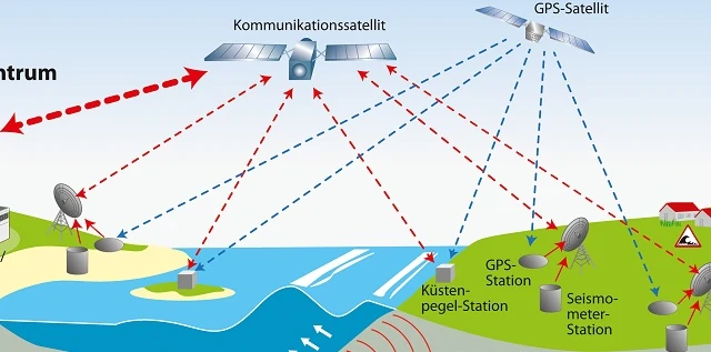
• The Level-1 tracks the magnitude of a tsunami and Level-2 generates an alert about a potential tsunami and wave height.
| 2004 Tsunami |
|
Speaking on the development, INCOIS Director SSC Shenoi said that in 2004, they were not able to predict the reach of the destructive tsunami waves. However, they had developed a model on sea surge that helped in predicting the penetration of waves on the land. The same model will now be used to predict how much distance a wave will cover after it breaches the coastline.
The model will also help in giving location-specific alerts.
Background
• The INCOIS issued an alert last month after high energy waves arising from a cyclonic circulation in the Atlantic off the South African coast hit the Indian coast.
• The INCOIS also conducted a detailed study on the topography of the Indian coast, as a part of the new model.
• The new warning service is likely to become operational by the end of 2018 or early 2019.
• During the 2004 disaster, India had provided alerts to the Southeast and South Asian nations.
• However, India would not be able to provide the new level-3 alert about the extent of inundation of the tsunami wave to these nations unless they provide the topographic data of their coasts.
• To enable the same, India is trying to develop a system for the nations under Regional Integrated Multi-hazard Early Warning System (RIMES).
| About RIMES |
| What- The Regional Integrated Multi-Hazard Early Warning System for Africa and Asia (RIMES) is an international and intergovernmental institution, owned and managed by its Member States, for the generation and application of early warning information. When- The council was established on April 30, 2009 and was registered with the United Nations on July 1, 2009. Why-The council is empowered to make policy decisions on behalf of governments, concerning regional early warning arrangements, for enhanced preparedness, response and mitigation of natural hazards. How- The council evolved from the efforts of Asian and African countries, in the aftermath of the 2004 Indian Ocean tsunami, to establish a regional early warning system within a multi-hazard framework for the generation and communication of early warning information and capacity building for preparedness and response to trans-boundary hazards. Composition- The council comprises heads of National Meteorological and Hydrological Services and national scientific and technical agencies generating multi-hazard early warning information. Members- The 12 member states of RIMES include Bangladesh, Cambodia, Comoros, India, Lao PDR, Maldives, Mongolia, Papua New Guinea, Philippines, Seychelles, Sri Lanka and Timor-Leste. Currently, India chairs the council.
|
| About RIMES |
| What - The Regional Integrated Multi-Hazard Early Warning System for Africa and Asia (RIMES) is an international and intergovernmental institution, owned and managed by its Member States, for the generation and application of early warning information.
When -The council was established on April 30, 2009 and was registered with the United Nations on July 1, 2009.
Why -The council is empowered to make policy decisions on behalf of governments, concerning regional early warning arrangements, for enhanced preparedness, response and mitigation of natural hazards.
How - The council evolved from the efforts of Asian and African countries, in the aftermath of the 2004 Indian Ocean tsunami, to establish a regional early warning system within a multi-hazard framework for the generation and communication of early warning information and capacity building for preparedness and response to trans-boundary hazards.
Composition -The council comprises heads of National Meteorological and Hydrological Services and national scientific and technical agencies generating multi-hazard early warning information.
Members – The 12 member states of RIMES include Bangladesh, Cambodia, Comoros, India, Lao PDR, Maldives, Mongolia, Papua New Guinea, Philippines, Seychelles, Sri Lanka and Timor-Leste. Currently, India chairs the council.
|


-1766148564075.jpg)
-1766148959440.jpg)
-1766142159494.jpg)
Comments
All Comments (0)
Join the conversation