
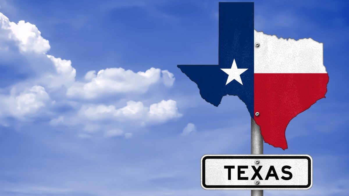
Situated in the south-central region of the United States, Texas stands as one of the 50 states, boasting a sprawling 560 km (350 mi) coastline along the Gulf of Mexico in the southeast and sharing a substantial 3,169 km (1,969 mi) border with Mexico.
Spanning the southwestern edge of Texas, the Rio Grande, its lengthiest river, demarcates the boundary with the Mexican states of Chihuahua, Coahuila, Nuevo León, and Tamaulipas. In the west, the Lone Star State, as it is affectionately known, abuts the state of New Mexico, while the Red River of the South delineates its western border with Oklahoma. To the east, Texas shares a concise border with Arkansas, defined by the Sabine River, which serves as a natural divide with Louisiana. Among its noteworthy rivers are the Brazos River, the Canadian River, the Colorado River, and the Pecos River. Renowned for its status as the largest state in the United States (before the integration of Alaska in 1959), Texas is synonymous with Bluebonnets, Texas longhorns, cowboy lore, tornadoes, the tragic site of President Kennedy's assassination, and its pivotal role in space exploration, notably embodied by Houston's famous phrase, "Houston, we have a problem."
ALSO CHECK| Map Of Michigan
Texas State Map
The comprehensive map delineates the boundaries of the state of Texas, pinpointing the strategic placement of its capital, Austin, along with major urban centres and populated areas.
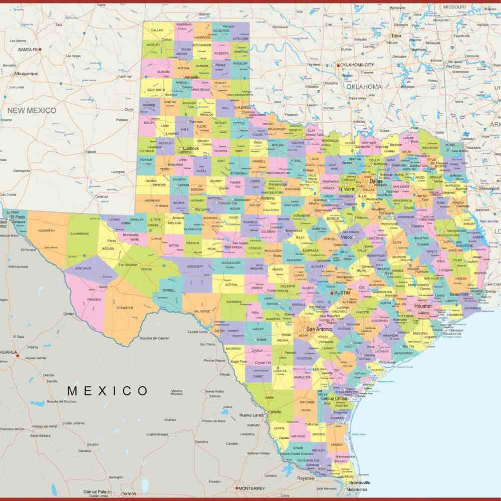
Noteworthy geographical features such as rivers, lakes, mountains, and their respective locations are meticulously depicted in the downloadable PDF. The intricate network of interstate highways, principal roadways, railroads, and airports, crucial elements of the state's transportation infrastructure, is clearly illustrated for comprehensive reference.
Texas Geographical Area
Encompassing a vast expanse of 696,241 km² (268,581 sq mi), Texas stands as the largest state within the contiguous United States. Its sheer magnitude is highlighted by a size approximately twice that of Germany and slightly surpassing that of Afghanistan. When juxtaposed with another U.S. state, Texas would snugly accommodate itself two and a half times within the borders of Alaska.
The topography of Texas generally unfolds as flat, except for the mountainous terrain situated to the west of the Pecos River. The state is characterised by four significant geographical regions:
1. Extending along the Gulf of Mexico, Texas' Gulf Coastal Plains is an expansive region in the Southern United States. This coastal expanse is distinguished by the presence of barrier islands, brackish water inlets, and bays. Within these coastal plains, a subdivision known as the Coastal Prairies exists, representing a modest remnant of native grassland. Astonishingly, this area, serving as a refuge for rare and endangered species, now comprises less than 1% of its original extent. In the southeast, the Piney Woods, an ecoregion of critical endangerment, bears remnants of coniferous forests. The Rio Grande Plain and the Lower Rio Grande Valley, situated to the west and south, also fall under the umbrella of the coastal plains. Additionally, temperate grassland ecoregions, namely the Texas Blackland Prairies and the Blackland Belt, manifest as temperate tallgrass prairies within this coastal domain. Transitioning between the Piney Woods and the Blackland Prairie is the Post Oak Belt.
2. Expanding into the northeastern reaches of Texas, the Interior Lowlands, also recognised as the North Central Plains, represent a southwestern extension of the interior lowlands. This region undergoes further categorisation, delineated into the Rolling Plains, characterised by expansive rangeland dedicated to wheat cultivation and cattle ranching. Notably, the predominantly treeless Grand Prairie prevails in this area, featuring an agricultural economy and a predominantly rural population. Except for Fort Worth, no sizable urban centres dot this landscape. Embedded within the Interior Lowlands are the Eastern and Western Cross Timbers, designated as Ecoregion 29. These strips of land exhibit a unique blend of partial forestation and usage for fruit and vegetable cultivation.
3. Stretching eastward from the Rocky Mountains, the Great Plains of Texas unfolds, showcasing the High Plains in the northern expanse—a sweeping, elevated plateau renowned as the Llano Estacado. This vast and flat terrain defines a significant geographical feature of the region. Marking the division between the High Plains and the lower West Texas Rolling Plains is the Caprock Escarpment, serving as the distinctive fault line. Further south, the Edwards Plateau, representing the lower extension of the Great Plains, sustains three pivotal industries: cattle, goat, and sheep raising. To the southeast, the Balcones Escarpment delineates its border, adding another layer of topographical significance to this expansive landscape.
4. Occupying the western expanse of Texas, the Basin and Range Province emerges as a distinctive geographical feature. Nestled within this province are the Guadalupe Mountains, housing the state's loftiest peak, the Guadalupe Peak, soaring to an elevation of 2,667 m (8,749 ft). This mountainous region adds a rugged and majestic dimension to West Texas. In the same western terrain lies the Davis Mountains, also referred to as the Limpia Mountains, characterised by their volcanic origin. These peaks contribute further to the diverse topography of West Texas. Expansive and arid, the Chihuahuan Desert, an ecoregion spanning eastern Mexico and Texas, blankets a substantial portion of West Texas and extends into parts of the middle and lower Rio Grande Valley. This desert landscape enhances the regional diversity, showcasing the stark beauty of arid environments.
ALSO CHECK| Map of California
Texas Cities and Towns
Below is a list of all the cities and towns in the State of Texas:
| Cities And Towns | |||||||||
| Abilene | Albany | Alice | Alpine | Amarillo | Andrews | Angleton | Anson | Arlington | Aspermont |
| Athens | Austin | Ballinger | Bay City | Baytown | Beaumont | Beeville | Big Spring | Bonham | Borger |
| Bowie | Brady | Brownfield | Brownsville | Brownwood | Bryan | Buffalo | Burnet | Canadian | Canyon |
| Carrizo Springs | Carthage | Cedar Park | Channing | Childress | Cisco | Clarendon | Clarksville | Cleburne | Coleman |
| College Station | Colorado City | Columbus | Conroe | Corpus Christi | Corsicana | Cotulla | Crockett | Crystal City | Cuero |
| Dalhart | Dallas | Del Rio | Denton | Dumas | Eagle Pass | Eden | EdnaVictoria | El Paso | Ennis |
| Fairfield | Falfurrias | Floydada | Fort Stockton | Fort Worth | Fredericksburg | Freeport | Gainesville | Galveston | Garland |
| George West | Georgetown | Gladewater | Goldthwaite | Goliad | Gonzales | Graham | Guthrie | Hallettsville | Hamilton |
| Harlingen | Henderson | Hereford | Hillsboro | Hondo | Houston | Huntsville | Irving | Jacksonville | Jasper |
| Johnson City | Junction | Kermit | Kerrville | Kilgore | Killeen | Kingsville | La Grange | Lake Jackson | Lamesa |
| Lampasas | Laredo | Levelland | Littlefield | Livingston | Longview | Lubbock | Lufkin | Luling | Madisonville |
| Marfa | Marlin | Marshall | Mason | McAllen | McCamey | McKinney | Mexia | Midland | Mission |
| Monahans | Mount Pleasant | Muleshoe | Nacogdoches | Nederland | New Braunfels | Odessa | Orange | Ozona | Paducah |
| Palacios | Palestine | Pampa | Paris | Pasadena | Pecos | Perryton | Pharr | Plainview | Plano |
| Port Arthur | Port Isabel | Port Lavaca | Post | Presidio | Robstown | Rocksprings | Rosenberg | Rusk | San Marcos |
| San Angelo | San Antonio | San Augustine | Sanderson | Seguin | Seminole | Seymour | Shamrock | Sherman | Sinton |
| Snyder | Socorro | Sonora | Stamford | Stephenville | Stratford | Sweetwater | Tahoka | Temple | Texarkana |
| Texas City | The Woodlands | Tyler | Uvalde | Van Horn | Vega | Vernon | Waco | Wharton | Wichita Falls |
| Woodville | |||||||||
Texas World Heritage Site
Established as a UNESCO World Heritage Site in 2015, the San Antonio Missions in Texas stand as a testament to the endeavours of Franciscan missionaries in the 18th century. Nestled along the San Antonio River basin in southern Texas, this cluster of erstwhile frontier missions and a ranch unfolds Spain's ambitious journey to colonise, evangelise, and extend the boundaries of New Spain.
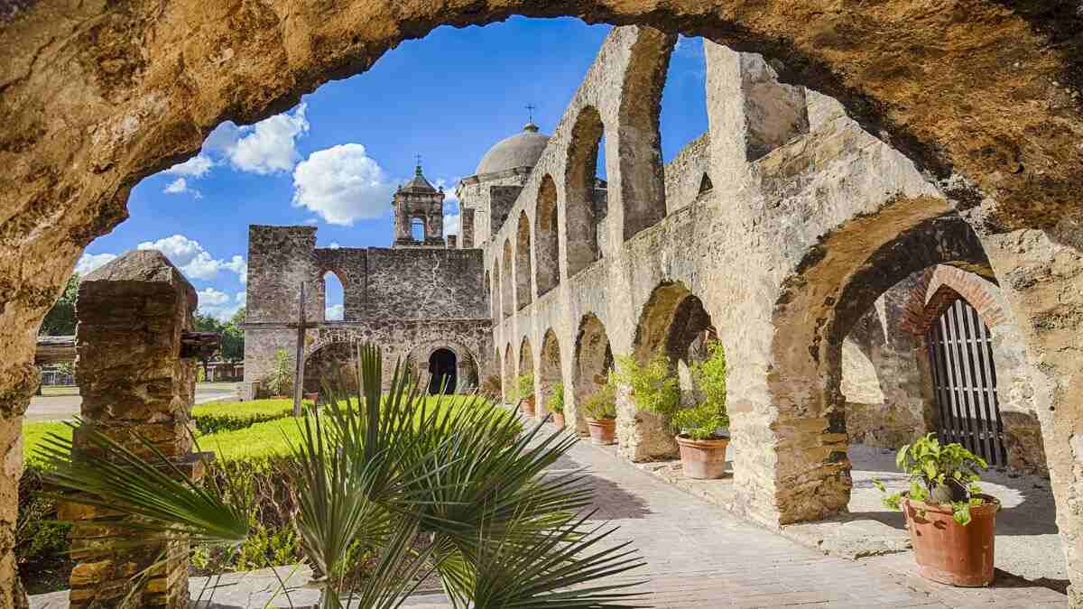
Constructed during the 18th century in the former Spanish Province of Texas, the facilities highlight the strategic efforts of Franciscan missionaries. The site vividly portrays Spain's multifaceted mission – from colonisation to evangelisation, culminating in the expansion of the northern frontier of New Spain. This property serves as a living chronicle, showcasing not only architectural and archaeological marvels but also encompassing farmlands, residences, churches, granaries, and sophisticated water distribution systems. The San Antonio Missions encapsulate a rich tapestry of history, providing a tangible connection to the past and preserving the legacy of Spain's pioneering influence in the region.
ALSO CHECK| Map Of Florida
Race and Ethnic groups
Below is the table summarising the Race and Hispanic Origin percentages:
| Category | Percentage |
| White alone | 77.40% |
| Black or African American alone | 13.40% |
| American Indian and Alaska Native alone | 1.10% |
| Asian alone | 5.70% |
| Native Hawaiians and Other Pacific Islanders alone | 0.20% |
| Two or More Races | 2.30% |
| Hispanic or Latino | 40.20% |
| White alone, not Hispanic or Latino | 39.80% |
Texas Population
With an estimated population of 30.5 million as of July 2023, Texas claims the position of the second most populous state in the United States, trailing only behind California. Austin serves as the state's capital, while Houston, the largest city and a pivotal port, stands as a prominent economic hub. San Antonio, the second-largest city in Texas, further contributes to the state's dynamic landscape.
Notably, the state's largest metropolitan area is the bustling Dallas–Fort Worth region, epitomising Texas's economic and cultural vitality. This demographic and geographical mosaic underscores the diverse and influential role that Texas plays on the national stage.
ALSO READ|


Comments
All Comments (0)
Join the conversation