NASA's Landsat 9- An eye from above monitoring the changing Earth- All you need to know
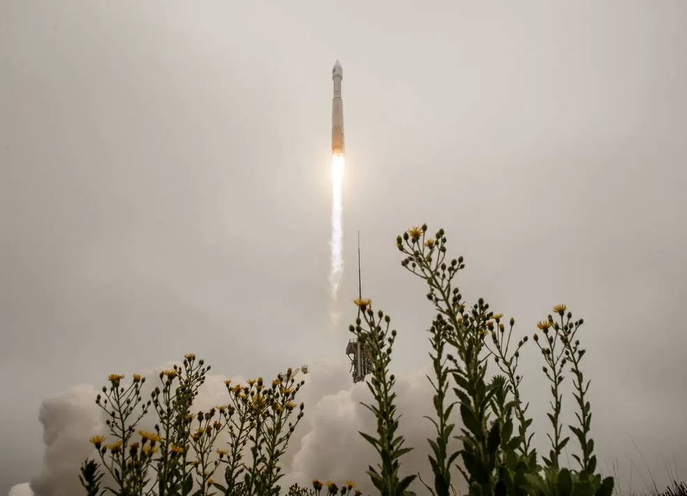
Landsat 9 has been launched by NASA to monitor the earth's surface.The satellite was launched on September 28, 2021 at 2:12 pm local time in the USA. Landsat is a part of a joint mission of NASA with US Geographical Survey (USGS).The satellite would be monitoring the changes that the Earth is seeing in its landscapes and its environment etc. Know all about the satellite in the article below.
Success! #Landsat 9 launched today to continue a nearly 50-year legacy of monitoring the health of our planet. A partnership with @USGS, the satellite will help people manage Earth's natural resources with science-based decisions: https://t.co/VlSDo6Kz8X pic.twitter.com/gTB6foW0ZT
— NASA (@NASA) September 27, 2021
LANDSAT-9: Details
- The satellite Landsat 9 is the ninth edition of the satellites launched in this series by NASA.
- Landsat 9 along with its sister satellite Landsat 8 would capture the images of Earth's land and coastal areas to find any changes that are taking place in the environment and landscape of the planet.
- It would take 8 days to circle the Earth which means one would get to see the complete image of the planet every 8 days.
- The satellite was launched from Vandenberg Space Force Base in California.
- The launch of Landsat-9 is a major milestone in the approximate 50-year joint partnership between USGS and NASA
As per NASA Administrator Bill Nelson, “NASA uses the unique assets of our own unprecedented fleet, as well as the instruments of other nations, to study our own planet and its climate systems.”
He added, “With a 50-year data bank to build on, Landsat 9 will take this historic and invaluable global program to the next level. We look forward to working with our partners at the U.S. Geological Survey and the Department of the Interior again on Landsat Next, because we will never stop advancing our work to understand our planet.”
Congratulations to @NASA and @USGS on the launch of #Landsat 9! Today’s launch will continue five decades of continuous Landsat Earth observation to monitor, understand, and manage land resources needed to sustain human life and measure the effects of climate change. https://t.co/m7tUxk6keM
— Vice President Kamala Harris (@VP) September 27, 2021
The two organizations, NASA and USGS have for many years collaborated to collect as much information about climate change and Earth's geography as possible.
Purpose of the Landsat Satellites:
The landsat satellites capture the images of agricultural productivity along with forest cover, health and water quality, coral reef habitat along with glacier dynamics.
The first landsat satellite was launched on July 23, 1972.
“Landsat 9 will be our new eyes in the sky when it comes to observing our changing planet,” said Thomas Zurbuchen, associate administrator for science at NASA.
Instruments on Landsat-9:
Landsat consists of the following instruments
-Operational Land Imager 2 (OLI-2)
-Thermal Infrared Sensor 2 (TIRS-2)
These would measure 11 wavelengths of light that may be reflected or radiated off Earth’s surface, in the visible spectrum as well as other wavelengths beyond the vision of human eyes.
As these satellites orbit, these instruments will capture scenes across a swath of 115 miles (185 kilometers).
Each pixel in these images represents an area about 98 feet (30 meters) across.
At that high a resolution, resource managers would easily identify most crop fields in the United States.


Comments
All Comments (0)
Join the conversation