India is a land of many waters. The country is home to over 400 rivers that flow across its vast landscape. These rivers are grouped into several major river basins, which are areas where all the water drains into a single large river. While the Brahmaputra is known as the widest river and the Ganges is celebrated as the longest and largest, each waterway has its own story. Many rivers even change names as they flow. For example, the Brahmaputra is called the Tsangpo in Tibet, and the Ganges becomes the Padma when it enters Bangladesh. But do you know which river basin covers the most land in India? Here are two clues: It is considered the most sacred river by millions of people. Secondly, it supports nearly half of India's population through farming and industry. In this article, we will take a look at the largest river basin in India, its path, and why it is so vital to the nation.
Which Is The Largest River Basin Of India?
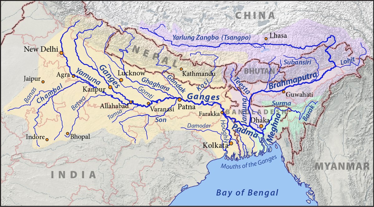
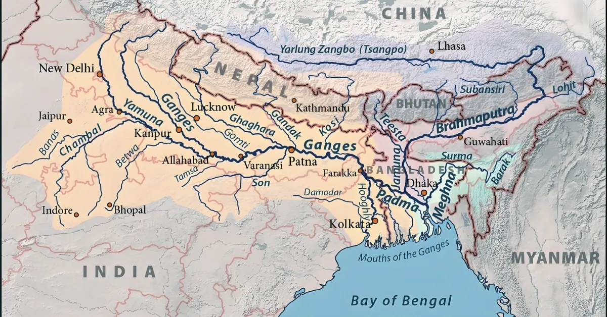
The Ganga Basin is the largest river basin in India. It covers nearly 26% of the country's total land area, spanning about 8.6 lakh square kilometres. The river begins its journey high in the Himalayas at the Gangotri Glacier in Uttarakhand. From there, it flows through the states of Uttarakhand, Uttar Pradesh, Bihar, Jharkhand, and West Bengal. Along its path, it is joined by many major tributaries like the Yamuna and the Son.
Finally, after travelling over 2,525 km, it enters Bangladesh and empties into the Bay of Bengal, forming the world's largest delta, the Sundarbans. This massive basin supports nearly half of India's population and is vital for the nation's farming and industry.
10 Lesser-Known Facts About the Ganga Basin
- The river contains high levels of bacteriophages, specialised viruses that kill harmful bacteria and keep the water fresher for longer.
- It is one of the few places on Earth where you can find the Ganges River Dolphin, a rare freshwater species that is practically blind.
- Scientific studies show that the Ganga can decompose organic waste up to 25 times faster than other major rivers worldwide.
- The river has an unusual ability to retain high amounts of dissolved oxygen, which helps it maintain its self-cleaning properties.
- Geologists believe the Ganga is older than the Himalayan mountains themselves, having carved its path as the land rose.
- Where the river meets the ocean, it has carved a massive underwater canyon called the "Swatch of No Ground" that is over 900 metres deep.
- The basin carries one of the highest sediment loads in the world, depositing millions of tonnes of fertile soil every year.
- The basin is home to over 140 fish species and 90 different amphibians, making it a critical ecological zone.
- The delta region contains many "char" islands that appear and disappear as the river shifts its path during the monsoon.
- If the Ganga Basin were its own country, it would be the third-most populous nation in the world, after China and India.
Which Is The Smallest River Basin In India?
The Arvari River Basin in Rajasthan is considered the smallest river basin in India. The river itself is only about 45 km long and flows through the Alwar district. Its basin covers a tiny area of approximately 492 sq. km. Remarkably, this river was once dry for 60 years but was brought back to life in the 1990s through community-led water conservation efforts, such as building small earthen dams (johads).
What Are The Top 5 Largest River Basins?
When ranking river basins based on the land area they cover strictly within Indian borders, the list is as follows:
- Ganga Basin: ~861,452 sq. km
- Indus Basin (within India): ~321,289 sq. km
- Godavari Basin: ~312,812 sq. km
- Krishna Basin: ~258,948 sq. km
- Brahmaputra Basin (within India): ~194,413 sq. km
What Are The Top 5 River Basins In India?
India's water resources are dominated by five primary systems that are vital for the country's economy and ecology:
- Ganga-Brahmaputra-Meghna System: The world's largest delta-forming system, supporting over 400 million people.
- Indus System: Vital for the northern states; it includes the five famous rivers of Punjab.
- Godavari System: Often called the "Dakshina Ganga", it is the largest system in Peninsular India.
- Krishna System: A primary source of irrigation and hydroelectric power for Maharashtra, Karnataka, and Andhra Pradesh.
- Narmada System: The largest west-flowing river system that drains into the Arabian Sea without forming a delta.
What is a River Basin?
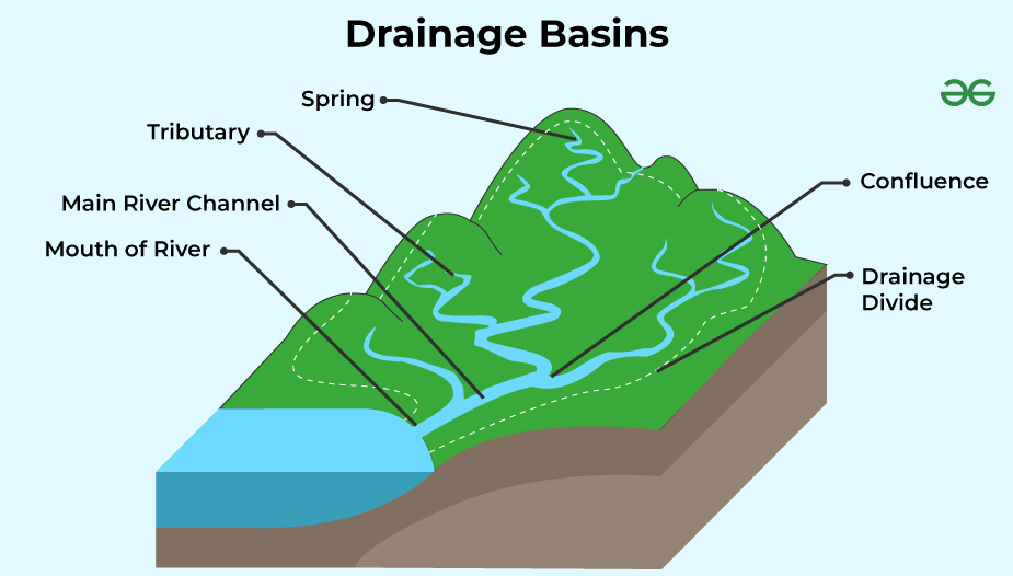
A river basin is the entire area of land where all surface water, from rain, melting snow, and smaller streams, flows into a single main river. Think of it as a giant, natural "bathtub". Just as a bathtub collects all the water that falls within its rim and directs it toward the drain, a river basin collects water from surrounding hills and ridges and funnels it into a single central river system that eventually empties into a lake or the ocean.
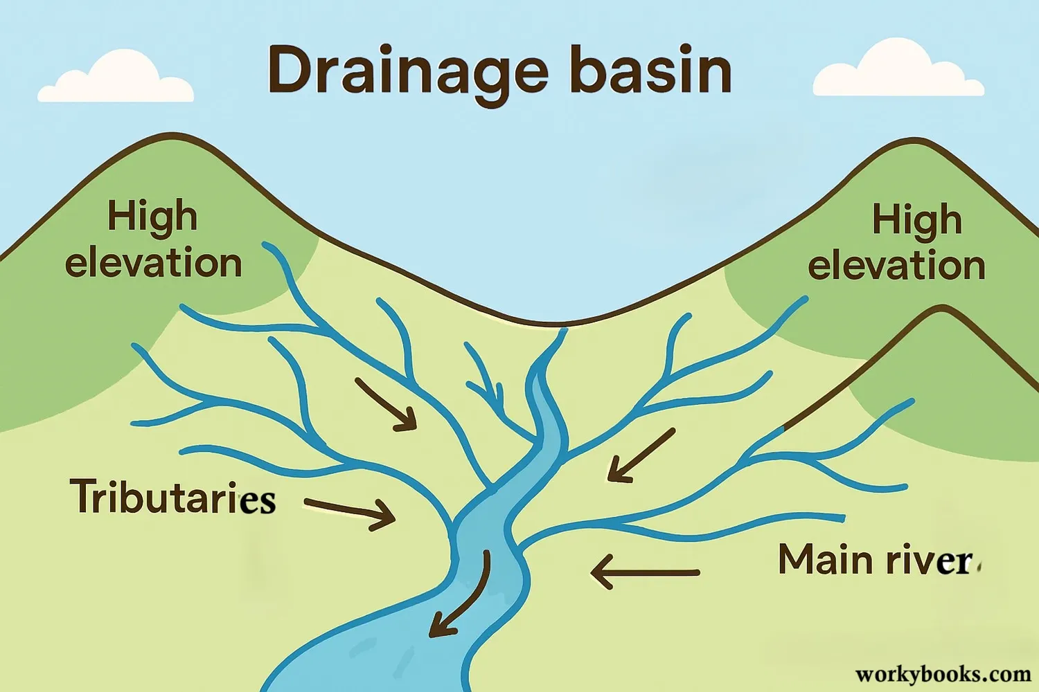
Every inch of land on Earth is part of a river basin. The boundaries of these basins are defined by high landforms, such as mountains or ridges, which act as a divide." Rain falling on one side of the ridge flows into one basin, while rain on the other side flows into a different one.
Examples of River Basins
- The Ganga Basin (India): This is a classic example of a large-scale system. Rainfall in the Himalayas or central India doesn't just sit there; it flows into smaller streams (tributaries) like the Yamuna or the Son. All these streams eventually merge into the Ganga, making the entire region they drain part of the Ganga Basin.
- The Amazon Basin (South America): The world's largest basin. It collects water from several countries, including Brazil, Peru, and Colombia. Every drop of water that falls in this massive area eventually finds its way into the Amazon River and out to the Atlantic Ocean.

-1766121936353.jpg "Which city is called the City of Seven Islands?")

-1766159625283.jpg)
-1766128662526.jpg)

Comments
All Comments (0)
Join the conversation